Hurricane Jerry has been gaining strength on a track that is predicted to carry it near the northern Leeward Islands on Friday and north of Puerto Rico on Saturday. The storm is now a Category 2 hurricane with winds of 105 mph but could lose strength over the next day or two. The storm is expected to take a turn toward the north and will stay away from Florida. Although the center of Jerry is expected to move north of the northern Leeward Islands, heavy rainfall and flash floods are possible there Friday. Jerry will pass well north of Puerto Rico on Saturday and be well east-northeast of the southeastern Bahamas on Sunday.Elsewhere in the tropicsA tropical wave behind Jerry could develop in the next week. It is currently located about 700 miles east of the Windward Islands and producing disorganized showers and thunderstorms. The wave is expected to move quickly westward at about 20 mph during the next few days, and some development is possible while it approaches and moves across the Windward Islands this weekend. Upper-level winds appear less conducive for development once the wave moves into the eastern Caribbean Sea early next week.Forecasters are also watching a wave that is expected to move off Africa this weekend. It will move west and has been given a 60 percent chance of development over the next five days. Forecasters say a tropical depression could form next week while the wave moves across the eastern tropical Atlantic.
Hurricane Jerry has been gaining strength on a track that is predicted to carry it near the northern Leeward Islands on Friday and north of Puerto Rico on Saturday.
The storm is now a Category 2 hurricane with winds of 105 mph but could lose strength over the next day or two.
The storm is expected to take a turn toward the north and will stay away from Florida.
Although the center of Jerry is expected to move north of the northern Leeward Islands, heavy rainfall and flash floods are possible there Friday.
Jerry will pass well north of Puerto Rico on Saturday and be well east-northeast of the southeastern Bahamas on Sunday.
Elsewhere in the tropics
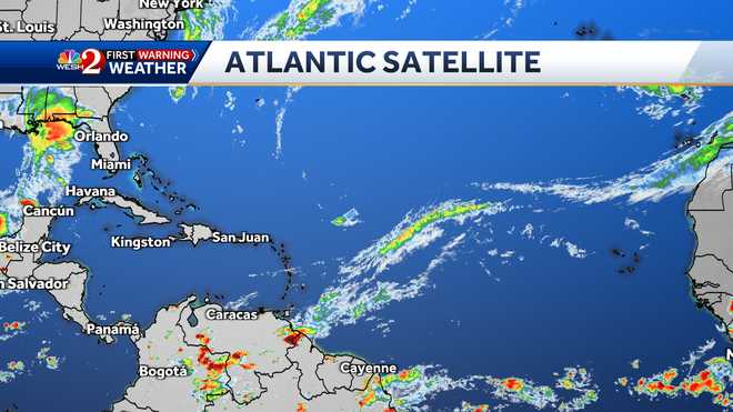
A tropical wave behind Jerry could develop in the next week. It is currently located about 700 miles east of the Windward Islands and producing disorganized showers and thunderstorms. The wave is expected to move quickly westward at about 20 mph during the next few days, and some development is possible while it approaches and moves across the Windward Islands this weekend. Upper-level winds appear less conducive for development once the wave moves into the eastern Caribbean Sea early next week.
Forecasters are also watching a wave that is expected to move off Africa this weekend. It will move west and has been given a 60 percent chance of development over the next five days. Forecasters say a tropical depression could form next week while the wave moves across the eastern tropical Atlantic.


Leave A Comment