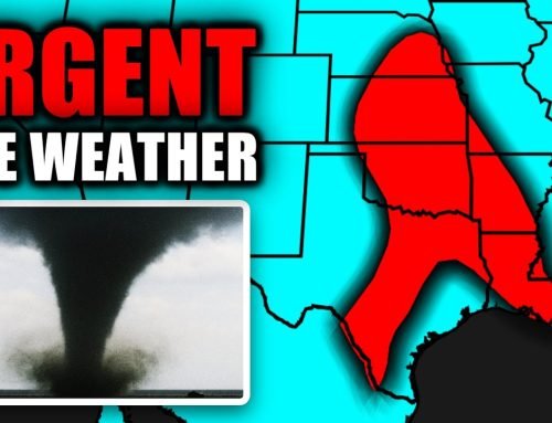
Satellite imagery shows Hurricane Dorian making its way to Florida as a cat 4
Hurricane Dorian continues its path toward Florida as a category 4 storm as the state prepares for a potential landfall sometime Tuesday.
Hurricane Dorian continues its path toward Florida as a category 4 storm as the state prepares for a potential landfall sometime Tuesday.
Dorian has frustrated the experts for days.
Back when Dorian was just a tropical storm, it was supposed to be somewhere on Florida’s coast by Saturday. At that point, it wasn’t even expected to ever grow into a hurricane.
Then, it started to strengthen. This prediction had everyone from Rolling Stones fans worried about a scheduled concert in Miami Gardens to mom and pop at home in Orlando contemplating water and gas runs.
Then it started to slow down. In fact, the timing of Dorian has been in a constant state of flux. So has the exact location of landfill, which essentially covered the entire state at one point.
But there was one thing the experts all agreed upon: it was going to hit Florida.
That is, until Saturday morning.
Saturday’s morning advisories suggest Dorian, a powerful Category 4, now could be a Florida coast chaser maybe not even making landfall as it follows a northward path up the Atlantic.
Unless it does.
Even as Dorian’s projected track shifted clear of South Florida, Commissioner Daniella Levine Cava described the mood in Miami on Saturday as one of “cautious optimism.”
“Our best hope is that Dorian stays at sea,” she said. “But hurricanes have minds of their own. This particular one has been a cliffhanger.”
Dorian joins a long line of hurricanes that have taken surprise turns and confounded the forecasters. Here are some of the most memorable.
Hurricane David (August-September 1979)
Hurricane David in 1979 would have been the first hurricane to hit South Florida in 14 years after Hurricane Betsy ripped the state in 1965. David didn’t follow the forecast.
Miami Herald File
“Hurricane David was a celebrity, a monstrous, fickle and thrilling celebrity. After 14 years without a hurricane, South Florida was primed with both fear and fascination for a king-sized hurricane,” the Miami Herald reported on Sept. 9, 1979.
What we got, after David devastated several Caribbean islands on its path to Miami, was “a minimal storm,” then hurricane-guru Neil Frank said. “An historical storm, no question about it, but a minimal one.”
David would have been South Florida’s first strike since Hurricane Betsy in 1965.
“But waiting for David’s wrath was like waiting for Skylab to fall. If it happened we surely couldn’t see it and didn’t hear it,” the Herald said.
David’s center missed Miami by 50 miles. Not a single gust of hurricane-force wind (74 mph) touched Miami-Dade as it blew into Palm Beach and Brevard County on its way to the Carolinas.
“If you live down here and are bragging to friends up North that you’ve been through a real hurricane then you’re lying. You haven’t and you don’t know what you missed,” the Herald chided.
Most of stayed indoors behind windows gunked up with ineffective tape, watching Kiss’ do disco on “The Jerry Lewis MDA Labor Day Telethon.”
We’ve learned a lot since then. Or not.
Hurricane Andrew (August 1992)
Hurricane Andrew was supposed to make landfall on the Miami-Dade/Broward County line. Instead, a last minute wobble put Andrew right in the Country Walk neighborhood of South Miami-Dade and devastated Homestead.
The Homestead Air Force Base was forever changed — it’s now an air reserve base. And the spaghetti bowl Golden Glades near the county line is still the same confusing mess it was in 1992 — except with more road construction.
Homestead Air Force Base would never be the same after Hurricane Andrew struck in August 1992. It is now an air reserve base.
Al Diaz
adiaz@MiamiHerald.com
Andrew also made then-WTVJ meteorologist Bryan Norcross a hero to many and mane him a household name nationwide. (He’s now working with WPLG-Local 10).
Hurricane Erin (July 1995)
Hurricane Erin formed as a tropical storm. On land. This one originated as a wave off the African coast, as many do, but didn’t become a tropical storm until it was already over the Turks and Caicos islands and southeastern Bahamas on July 30, 1995, the Weather Channel reported.
Tropical storm warnings could not be issued until Erin was already battering populated islands in the Caribbean.
Erin turned into a hurricane and made landfall near Florida’s Vero Beach as a Category 1 on Aug. 2, 1995.
Hurricane Floyd (September 1999)
A curious onlooker stands in the surf watching as Hurricane Floyd hammers the Jacksonville Beach Pier on Sept. 15, 1999, in Jacksonville Beach, Florida.
WILFREDO LEE
AP
Hurricane Floyd intensified rapidly to just below a Category 5, with 155 mph winds, after it spun off Cape Verde on its forecast path to Florida.
Floyd wreaked havoc on the Bahamas at peak Category 4 strength, dipped to a Cat 3, then set its sights on Florida and regained Cat 4 strength.
Floyd paralleled the eastern Florida coast 110 miles off shore for about a day, sparking evacuations and pounding surf from Miami to Jacksonville. But then dry air and upper-level shear conspired to push Floyd away from Florida and sent a weaker version as a Category 2 to make landfall at the appropriately-named Cape Fear in North Carolina.
Tropical Storm Allison (June 2001) and Hurricane Humberto (September 2007)
Allison couldn’t wait to happen, either. The storm didn’t allow forecasters to, well, make their forecasts in timely fashion in June 2001.
Just 15 hours elapsed between Allison’s formation as a tropical storm on June 5, 2001, and its landfall in southeast Texas late that same evening, the Weather Channel reported. Allison only gave forecasters a scant three hours to make official tropical storm warnings before its 60 mph tropical storm force winds reached the upper Texas coast. Normally, the National Hurricane Center would like to let the public know at least a day out.
Hurricane Humberto in September 2007 was another fast-starter, confounding the experts by intensifying from tropical depression off Galveston, Texas, to hurricane status in just 19 hours, before arriving in High Island, Texas, on Sept. 14, 2007, the Weather Channel said.
Hurricanes Katrina (August 2005) and Wilma (October 2005)
Radar image shows Hurricane Katrina making landfall in Florida in 2005.
We got a little complacent after Andrew. There was a 13 year lull in South Florida before the one-two punch of hurricanes Katrina, which became synonymous with New Orleans, and Wilma in 2005, a season itself that surprised the experts.
The 2005 Atlantic hurricane season became the most active season on record with seven major hurricanes making landfall — including the worst five, Dennis, Emily, Katrina, Rita and Wilma.
“I remember Katrina as surprisingly fierce for a Category 1,” Peter Schmitt wrote in response to a Miami Herald and Public Insight Network query on memories of that crazy 2005 Atlantic hurricane season.
Katrina “had taken a sharp southwest turn and churned down over us here near Dadeland, its gathering strength perhaps a harbinger of what it would become or the damage it would unleash,” Schmitt recalled. “Wilma was a long overnight slog and more destructive than one might initially have imagined.“
Hurricane Matthew (October 2016)
That blessed “eyewall replacement.”
That’s what South Floridians must have been thinking when forecasters — and Bryan Norcross — believed that changes within the eyewall that, at the last moment, caused Matthew’s edge to wobble just 20 to 30 miles east. That little and unexpected nail-biting change sent Matthew off its Miami-Dade or Broward target and steered it along Florida’s coastline instead.
Instead, Matthew’s shift about 20 miles east meant the storm passed 76 miles east of Boca Raton, about 64 miles east of West Palm Beach, 50 miles east of Stuart and 38 miles west of Vero Beach, the Sun Sentinel reported.
South Florida’s almost certain Category 1 winds and stronger 90 mph gusts were closer to 60 mph gusts.
Matthew was still a nasty Florida event, leading to 12 deaths and $2.77 billion in damage, according to NOAA.
Matthew skirted especially close to Brevard County, with sustained winds up to a Category 2. Winds reached 80 mph at Kennedy Space Center and Volusia County endured half a day’s worth of sustained tropical storm-force winds.
A man in Jacksonville died when he fell off his roof while trying to do repairs during Matthew, WTLV reported.
Hurricane Irma (September 2017)
Anne’s Beach at mile marker 73 in Lower Matecumbe Key has been closed since Hurricane Irma washed away its boardwalk in September 2017.
David Goodhue/dgoodhue@flkeysnews.com
Hurricane Irma was initially supposed to skirt the west coast of Florida, according to National Hurricane Center consensus early on, meteorologist Marshall Shepard wrote for Forbes. “Some models even had [Irma] staying just off the coast,” he wrote.
Then Doppler radar’s “rainfall footprint” indicated that Irma shifted a bit eastward and tracked more up the peninsula and was going more inland. “This subtle shift had significant implications,” Shepard wrote.
“Some meteorologists and atmospheric scientists (me included) speculate that the asymmetric nature of the rainfall (and associated heating in the clouds) could have been responsible for the slight nudge eastward,” Shepard wrote.
We all know what happened, right Florida Keys?
Miami Herald staff writer Daniel Chang contributed to this story.


Leave A Comment