Karen barely a tropical storm with an uncertain future, NHC says
Show Transcript
TONY: A NICE NIGHT OUT THERE. PLENTY OF HEAT TOMORROW. SOME SLIGHT COOLING FOR THE WEEKEND. MEREDITH: EMPHASIS ON SLIGHT. [LAUGHTER] STEWART: I DO NOT MIND IT HOT. I’M JUST SAYING. THE CALENDAR DOES NOT MATCH UP. IT’S NOT YOUR FAULT. IT IS ONLY TONY’S FAULT WHEN IT RAINS ON WEEKENDS. TONY: I’M WALKING AWAY. [LAUGHTER] 77 IN OCALA. MORE JUICE IN THE ATMOSPHERE. THE DEW POINTS THE LAST FEW NIGHTS WERE IN THE LOW 60’S. TONIGHT, THE LOW 70’S. THAT TELLS US THE AIR IS MORE MOIST. IT WILL FEEL UNFORTUNATELY A LITTLE MORE LIKE LATE AUGUST. NOT LATE SEPTEMBER. THE RADAR IS QUIET. CELEBRATION, 79. ST. CLOUD, 75. LAKE MARY, GENEVA, CONWAY, WINDEMERE, 78 TO 80. PALM COAST, 78. DAYTONA BEACH, 78. DEBRIS TEMPERATURES NORTH AND WEST OF I-4, UPPER 60’S. — DAYTIME TEMPERATURES NORTH AND WEST OF I-4, UPPER 60’S. AND I START TOMORROW. AN ISOLATED — A NICE START TOMORROW. AN ISOLATED SHOWER CANNOT BE RULED OUT. FRIDAY, WITH HIGH-PRESSURE SHIFTING TO THE EAST, WE HAVE A DEEPER ONSHORE FLOW. THAT WILL START A COOLING TREND. INSTEAD OF THE 90’S, WE WILL BE IN THE 80’S. TOMORROW, GET OUT AND ENJOY THE WARM WEATHER. NEAR 90 AT THE BEACH. INLAND, 92 TO 94. IF YOU ARE GOING TO HER FAVORITE ATTRACTIONS, IT WILL BE HOT BY 3:00. 91. A DEEP EASTERLY FLOW. AFTERNOON HIGHS IN THE UPPER 80’S. LOCAL SHOWERS FROM TIME TO TIME. 89 ON SATURDAY. 88 ON SUNDAY. A BETTER CHANCE FOR SHOWERS ON SUNDAY. LORENZO AND KAREN ARE THE REMAINING STORMS. RAIN STILL INTACT OVER PUERTO RICO. THAT WILL PULL WESTWARD AND HIGH PRESSURE WILL BUILD IN AND KAREN WILL SLIDE TO THE WEST. TOWARD THE END OF NEXT WEEK, WE COULD BE DEALING WITH AN INCREASED RAIN CHANCE THROUGH THE BAHAMAS AND FLORIDA. KAREN WILL CURL TO THE WEST MONDAY THROUGH WEDNESDAY AND INTO THURSDAY. MOISTURE BUILDING TOWARD SOUTH AND CENTRAL FLORIDA. WE WILL CONTINUE TO MONITOR THIS. ANYTHING HAVING OUR WAY — HEADING OUR WAY WILL NOT BE SIGNIFICANT. WE COULD USE THE RAIN. NEXT FEW DAYS, 90’S. SATURDAY AND SUNDAY, UPPER 80’S. NEXT WEEK, BETTER RAIN CH
Karen barely a tropical storm with an uncertain future, NHC says
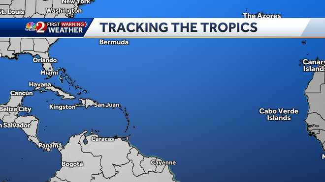
Tropical Storm Karen is moving away from Puerto Rico after dumping heavy rain over parts of the island. Karen is forecast to head north-northeastward before eventually slowing down this weekend and making a clockwise loop over the Atlantic. After the storm makes that loop, it could head to the west. The storm drenched south-central Puerto Rico, causing a river to wash away a bridge and cutting off at least 15 families, the National Weather Service said late Tuesday.As of 11 p.m. Wednesday, Karen was located about 445 miles NNE of San Juan. The storm had sustained winds up to 40 mph as it moved NNE at 15 mph.Little change in strength is forecast during the next several days.Tropical Storm Karen maps and modelsThe National Hurricane Center said that Lorenzo became the fifth Atlantic hurricane of the 2019 season on Wednesday morning. As of 11 p.m. Wednesday, Lorenzo was located about 915 miles west of the southernmost Cabo Verde Islands. The storm was moving to the west-northwest at 15 mph and had top sustained winds of 100 mph. Additional strengthening is forecast during the next couple of days. Hurricane Lorenzo maps and models
Tropical Storm Karen is moving away from Puerto Rico after dumping heavy rain over parts of the island.
Karen is forecast to head north-northeastward before eventually slowing down this weekend and making a clockwise loop over the Atlantic. After the storm makes that loop, it could head to the west.
The storm drenched south-central Puerto Rico, causing a river to wash away a bridge and cutting off at least 15 families, the National Weather Service said late Tuesday.
As of 11 p.m. Wednesday, Karen was located about 445 miles NNE of San Juan. The storm had sustained winds up to 40 mph as it moved NNE at 15 mph.
Little change in strength is forecast during the next several days.
Tropical Storm Karen maps and models
The National Hurricane Center said that Lorenzo became the fifth Atlantic hurricane of the 2019 season on Wednesday morning.
As of 11 p.m. Wednesday, Lorenzo was located about 915 miles west of the southernmost Cabo Verde Islands. The storm was moving to the west-northwest at 15 mph and had top sustained winds of 100 mph. Additional strengthening is forecast during the next couple of days.
Hurricane Lorenzo maps and models
Source link


