
Tropical Storm Jerry strengthening, likely to become hurricane soon

Updated: 11:31 PM EDT Sep 18, 2019
Show Transcript
PAYING ATTENTION TO THE TROPICS. IS ANYTHING COMING OUR WAY? TONY: NOTHING POINTING IN OUR DIRECTION. THE COLD FRONTS COMING IN ARE REALLY HELPING TO STEER EVERYTHING OUT TO SEA. ONE COLD FRONT IS COMING TOMORROW AND YOU WILL NOTICE A CHANGE IN THE ATMOSPHERE. THROUGH THE 90 — THROUGH THE WEEKEND, WE WILL BE IN THE 80’S. DOWNTOWN ORLANDO, IT IS 77°. LOOK AT THE DEW POINT. UPPER 60’S. YOU CANNOT QUITE OPEN YOUR WINDOW, BUT WE ARE GOING IN THE RIGHT DIRECTION. A BIG DOME OF HIGH-PRESSURE IS BEHIND HUMBERTO AND THAT IS PART OF THE REASON WE ARE GETTING DRIER AIR. WE HAVE A HIGH THAT WILL FORCE THE STATIONARY FRONT TO THE SOUTH. AHEAD OF IT, WE HAVE SOME LATE EVENING SHOWERS. THESE ARE DRIFTING TO THE SOUTH SOUTHWEST. JUST A LONG I-4. FOR THOSE OF YOU WITH TRAVEL PLANS, THE ROADS WILL BE WET. BITHLO, AVALON PARK, UCF, SOME FAST-MOVING SHOWERS. FROM ROCKLEDGE TO THE WESTERN SIDE OF MELBOURNE, SOME GOOD RAIN. MODERATE TO HEAVY GETTING READY TO JUMP OVER 192. KENANSVILLE IS QUIET. GIVE US ABOUT 45 MINUTES AND WE WILL HAVE SOME WET WEATHER. TEMPERATURES ARE NOT BAD. LOW TO MID 70’S UP NORTH. NEAR 80 AND BREVARD COUNTY. THE FLOW OF AIR IS COMING IN OFF OF THE ATLANTIC. THE DRIER AIR IS TRYING TO GRADUALLY BUILD IN. NICE AND COMFORTABLE OUT THE DOOR. SHOWERS TOMORROW AFTERNOON AS THE FRONT WORKS THROUGH. THEN IT WILL STALL OUT TO THE SOUTH OVER NEAR FORT MYERS FRIDAY. THAT WILL KEEP DEEPER MOISTURE DOWN TO THE SOUTH. THE FARTHER NORTH YOU GO, THE MORE PLEASANT IT WILL BE. PALM COAST TOMORROW, 83. IN TOWN, 85. A NORMAL HIGH THIS TIME OF YEAR IS NEAR 90. THE OTHER CONCERN TOMORROW IS THE BOAT AND BEACH FORECAST. THE NEARSHORE BREAKERS ARE FIVE TO 7 FEET. RIP RISK WILL BE HIGH. KEEP YOUR BOATS IN. THERE ARE FIVE CIRCLES OUT THERE. NONE OF WHICH ARE POINTED TO CENTRAL FLORIDA. JERRY WILL BE MOVING OFF TO THE WEST NORTHWEST. WE HAVE TROPICAL STORM WATCHES FOR THE NORTHERN LEEWARD ISLANDS. A COLD FRONT WILL BEGIN TO STEER THIS WELL OFF TO THE EAST OF CENTRAL FLORIDA. THAT IS GOOD NEWS. IN THE WAKE OF JERRY, SOME OTHER DISTURBANCES WILL TRY TO GET GOING. ONE NEAR SAN JUAN. ANOTHER COLD FRONT WILL MOVE IN AND SO FOR THE TIME BEING, WE ARE IN GOOD SHAPE. A FEW SHOWERS THURSDAY AND FRIDAY. NOTICE THE GREAT WEA
Tropical Storm Jerry strengthening, likely to become hurricane soon
Updated: 11:31 PM EDT Sep 18, 2019
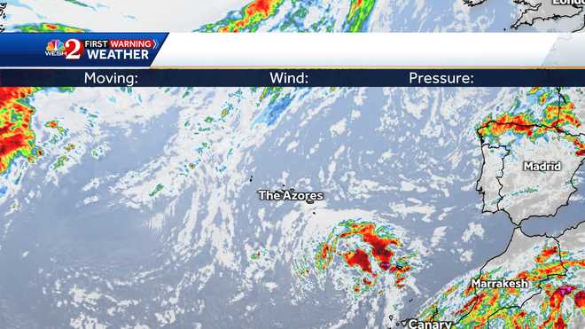
Tropical Storm Jerry is strengthening and it likely to become a hurricane soon, according to the National Hurricane Center.Jerry formed in the Atlantic, east of the Caribbean. It is the 10th named storm of the 2019 Atlantic hurricane season.As of 11 p.m. Wednesday, Jerry was moving toward the west-northwest near 15 mph with maximum sustained winds of 65 mph. Jerry was about 675 miles east of the Leeward Islands.The storm is expected to eventually curve north, away from Florida.Meanwhile, as of 11 p.m. Wednesday, Hurricane Humberto was moving toward the northeast at 23 mph. The storm was located about 130 miles NNE of Bermuda and maximum sustained winds were at 120 mph.The Bermuda Weather Service has changed the Hurricane Warning to a Tropical Storm Warning for Bermuda.The hurricane should start to weaken later Wednesday night, and it is expected to become a post-tropical cyclone by Friday.
Tropical Storm Jerry is strengthening and it likely to become a hurricane soon, according to the National Hurricane Center.
Jerry formed in the Atlantic, east of the Caribbean. It is the 10th named storm of the 2019 Atlantic hurricane season.
As of 11 p.m. Wednesday, Jerry was moving toward the west-northwest near 15 mph with maximum sustained winds of 65 mph. Jerry was about 675 miles east of the Leeward Islands.
The storm is expected to eventually curve north, away from Florida.


Meanwhile, as of 11 p.m. Wednesday, Hurricane Humberto was moving toward the northeast at 23 mph. The storm was located about 130 miles NNE of Bermuda and maximum sustained winds were at 120 mph.
The Bermuda Weather Service has changed the Hurricane Warning to a Tropical Storm Warning for Bermuda.
The hurricane should start to weaken later Wednesday night, and it is expected to become a post-tropical cyclone by Friday.


Leave A Comment