
Thunderstorms can come in several destructive varieties
The National Weather Service explains the four types of thunderstorms: single cell; multi-cell cluster; squall line; and supercell. Thunderstorms can produce dangerous lightning, damaging hail and winds, tornadoes and flash flooding.
The National Weather Service explains the four types of thunderstorms: single cell; multi-cell cluster; squall line; and supercell. Thunderstorms can produce dangerous lightning, damaging hail and winds, tornadoes and flash flooding.
A disturbance near the Bahamas has a high chance of turning into a tropical cyclone in the next few days, with a tropical depression likely to form as it moves across Florida this weekend, according to forecasters.
The trough of low pressure that is producing “widespread cloudiness, showers and thunderstorms” near the southeastern Bahamas has a 50 percent chance of developing into a tropical cyclone in the next 48 hours, according to the National Hurricane Center.
But those chances rise to 70 percent in the next five days, with the possibility of a tropical depression forming as the system moves northwest at 5 to 10 mph across the Florida Straits, South Florida and into the eastern Gulf of Mexico, according to Thursday morning’s advisory.

There is a high chance a tropical depression will form as the weather system moves across the Florida Straits, South Florida and into the eastern Gulf of Mexico, according to the National Hurricane Center’s 2 a.m. advisory Thursday.
National Hurricane Center
On Wednesday, the system had a slightly lower chance of becoming a tropical cyclone.
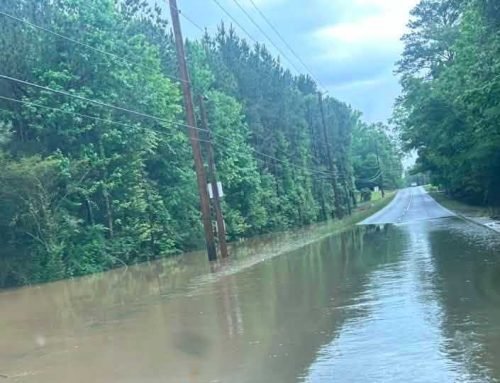
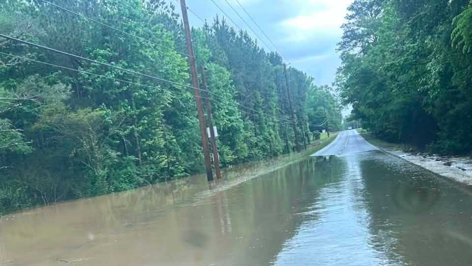
Regardless of development, the disturbance is expected to bring periods of heavy rain and gusty winds across the Bahamas through Friday and across Florida during the weekend.
The good news is that the Atlantic is looking slightly less active Thursday morning. One of the tropical waves forecasters were keeping an eye on Wednesday no longer has the possibility of becoming a tropical cyclone.
The other wave, which is just west of the Cabo Verde Islands as of Thursday morning, is producing a “small area of disorganized showers and thunderstorms,” and has a zero percent chance of developing into a significant weather system in the next 48 hours. In the next five days, those chances increase to 40 percent.
Forecasters say a tropical depression could form early next week while the system moves westward over the Atlantic toward the Lesser Antilles

Real Time/Breaking News Reporter. There’s never a dull moment in Florida — and I cover it. Graduated with honors from Florida International University. Find me on Twitter @TweetMichelleM


Leave A Comment