Northern California is bracing for yet another powerful storm that’s expected to drench the already-battered region with heavy rain and strong winds on Wednesday, prompting concerns of flooding, landslides and power outages.
A moisture-rich atmospheric river — fed by a plume of subtropical water vapor at the lower and middle levels of the atmosphere — is expected to bring wind gusts up to 60 miles per hour and more than 6 inches of rain in some parts of the Bay Area.
“The strong winds we’re expecting today on already-saturated soils and additional rainfall expected in the next 24 to 48 hours are really going to exacerbate the flooding concerns and the potential for wind damage and downed trees,” said Roger Gass, a meteorologist with the Bay Area National Weather Service.
Rain had already begun falling across the region Wednesday morning, but forecasters say the brunt of the storm will likely hit in the afternoon with rain lasting through Thursday.
The weather service is warning of rapid rises in area creeks, streams and rivers across the region, as well as gusty winds that will likely bring trees and branches down, causing “localized damming of water ways.”
“To put it simply, this will likely be one of the most impactful systems on a widespread scale that this meteorologist has seen in a long while,” the weather service said in its forecast for Northern California, adding that widespread flooding, downed trees, power outages and hillside collapses are likely.
Wednesday’s so-called Pineapple Express storm comes on the heels of a New Year’s Eve storm that dumped more than 5 inches of rain in San Francisco. It was the area’s second wettest day in more than 170 years of records, officials said.

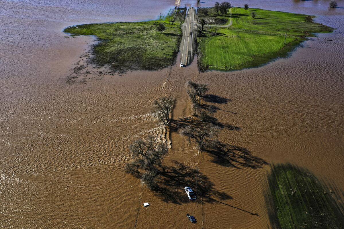
Three vehicles are submerged on Dillard Road west of Highway 99 in south Sacramento County in Wilton on Jan. 1after heavy rains on New Year’s Eve produced levee breaks.
(Hector Amezcua/The Sacramento Bee)
Across Northern California, creeks filled, rivers rose and floodwaters began to surge in recent days, stranding motorists and spurring evacuations. At least one person was killed when waters from the Cosumnes River in Sacramento County rushed over levees.
A portion of the city of Watsonville in Santa Cruz County was ordered to evacuate Tuesday night. With the incoming rain, authorities became concerned that a culvert under a major street that was damaged in a previous storm could fail making the roadway impassable for medical and law enforcement resources, according to the Santa Cruz County Sheriff’s Office.
In San Jose, officials were working to evacuate unhoused people staying near creeks in the city over concerns that they could be swept away during the storm.
Nearly 500,000 Pacific Gas & Electric customers lost power during the New Year’s Eve storm and the utility is planning to deploy additional crews to deal with possible outages on Wednesday.
The series of atmospheric rivers that started toward the end of December came as something of a shock after one of California’s driest years on record, which left reservoirs drained and soils dry as a bone.
Experts say while the system is expected to bring heavy rain, it’s not simply the strength of this storm on it’s own that has prompted damage concerns, but instead the culmination all the recent storms.
In October 2021, a similarly strong atmospheric river brought significant rainfall to the state but did not cause nearly the same amount of damage because the conditions leading up to it were more dry, said Daniel Swain, a climate scientist at UCLA.
Now, “it’s going to take a much lesser storm to produce much greater impacts given how wet it is,” he added.
San Francisco Mayor London Breed said the city was “preparing for a war” as officials passed out sandbags and residents prepared for another several days of rain.
Sacramento and other areas are also bracing for the powerful storm.
The Sacramento Valley can expect an additional 2 to 4 inches of rain Wednesday through late Thursday. Some areas in the foothills could see up to 6 inches on top of all the rain from the days prior, according to the weather service.
The weather service has also issued flash flood watches in several burn areas, including the area of the August Complex fire, the River Complex fire, the Mosquito fire and the western region of the Dixie fire.
The agency advised residents in or near such areas to “prepare to leave before the storm arrives and stay tuned to local authorities for any possible evacuation warnings.”
